Upgrade and modernize your flight deck with integrated solutions for an intuitive head-up/head-down experience.
Flight Management Connectivity Flight Displays Enhanced Vision Flight Recorders Communications View Products by MarketGet questions answered, discover online training and documentation, request help, and more.
Repair and Warranty FAQs Training Release Schedule Type 2 LOA Status InSight™ Navigation TAWS & Vision-1™Stay informed with the latest news and announcements, featured in the press and on our blog.
Learn More Press Releases UA Blog Brochures & Whitepapers Events Technical Publications UA Academy UniNetLearn about our history and products, discover careers, and meet the team.
About Us Careers Our Team Our LocationsConnect with our team via email, phone, or in-person at our global office locations.
Find a Dealer Contact UsUpgrade and modernize your flight deck with integrated solutions for an intuitive head-up/head-down experience.
Get questions answered, discover online training and documentation, request help, and more.
Stay informed with the latest news and announcements, featured in the press and on our blog.
Learn MoreLearn about our history and products, discover careers, and meet the team.
Connect with our team via email, phone, or in-person at our global office locations.
Have a general inquiry? Submit a contact request we can get back to you.
Inquire about our avionics and discover the best option to fit your aircraft.
Get personalized account support or request services for databases, warranty, or repairs.
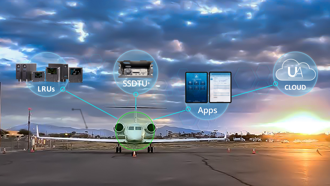
Technology has rapidly increased the amount of flight data that is collected and available. But without the ability to make sense of this data, it’s just noise. How you access and interpret available information is critical to your success. Connect Information between human operators, avionics systems, and ground operations so you can understand your environment for proactive decision-making in all phases of flight.
Download Product Information
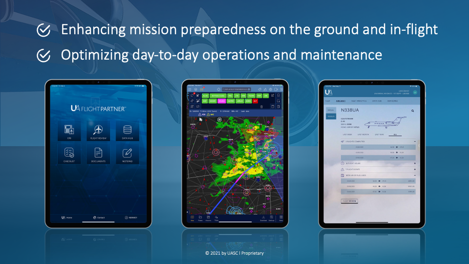
The FLIGHTPARTNER App is designed for UA’s Connectivity Ecosystem including flight planning, weather data, charting VFR sectional maps, IFR low/ high charts, and geo-referenced approach plates, airport information, document management, flight logging. It also includes support for TAWS, and AHRS with synthetic vision.
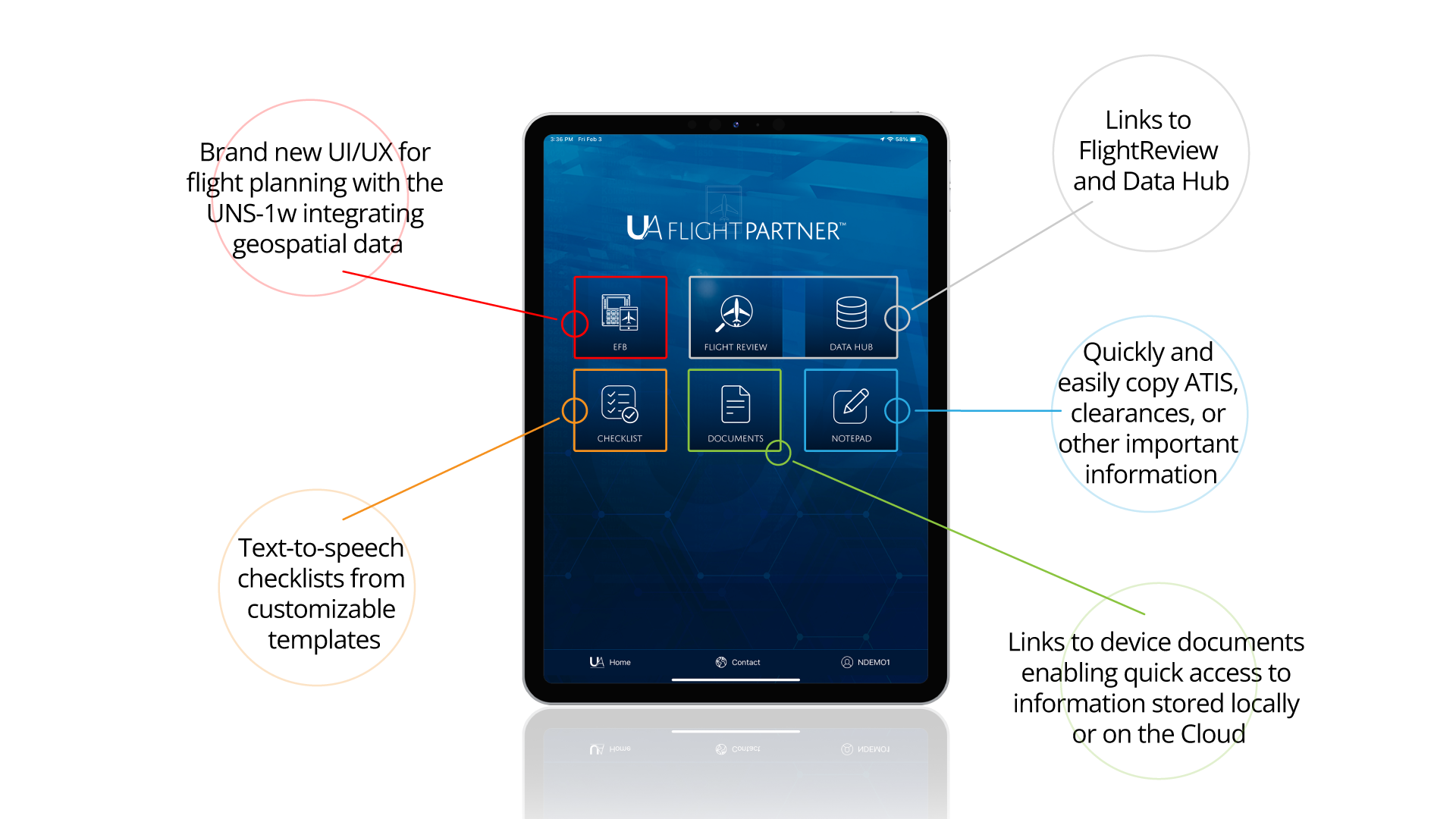
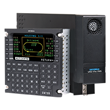
FLIGHTPARTNER is designed to operate in tandem with Universal Avionics' FMS, enabling two-way exchanges of flight plan data in all phases of flight.
Based on pre-flight and on-board flight related planning activities, the App delivers updated flight plans to the FMS including temperatures and winds aloft, saving pilots substantial time. When flight plan changes are entered into UA’s FMS, whether to avoid a storm or because of ATC request, the FLIGHTPARTNER App is immediately updated.
The Smart Flight Planning (SFP) tool offers an intuitive flight plan edition and review mode complemented by weather-driven recommendations such as icing conditions, storms, and airport visibility.
The App goes beyond simply listing alternate airports, it provides detailed insights including considering fuel stops and day/night currency in your alternate flight planning. File, amend and close VFR flight plans globally and IFR flight plans in the U.S. and Europe.
The SFP is designed to give pilots a deeper understanding of weather for improved preflight planning. The SFP also supports Smart alerting covering Terrain, Icing in route, METAR and other airport specific conditions such as visibility and crosswind reports for the intended takeoff and landing runway.
The Map function of FLIGHTPARTNER includes a comprehensive moving map integrating FMS flight context and aircraft position at all times. A choice of VFR sectional maps, IFR low/high charts, or vector maps (*) can be combined with information layers that include advisory, navigation and weather-related information. This information can be uniquely organized by user preferences to ease workflow.
Vector maps and on-screen flight planning is supported by the same nav database as used for the UA WAAS FMS. Weather information can be layered on the maps in various configurations depending on the aircraft mission. This includes geo-referenced icing charts (CIP and FIP), prognostic and surface analysis charts, SPC outlooks, SPC mesoscale discussions, SkewT soundings, and more.
Additional weather data supported by the app include base radar, composite radar, and future radar simulations three days out. Visible color-coded infrared, enhanced infrared, and water vapor satellite imagery. TAF Discussions, GFS and NAM MOS forecasts by airport.
(*) Charting coverage: VFR and IFR charts from the FAA, NAV CANADA, EUROCONTROL, as well as other sources to give you everything you need for any type of flying
A key feature of the FLIGHTPARTNER app is its weather modeling products including Radar Forecast and Vertical Weather Profile. . The Vertical Weather Profile previews your route in the vertical slice from departure to destination, so you can see the conditions you’ll encounter based on your departure time, aircraft speed, and each intermediate nearby airport. This tool provides information eight days out, although advisories such as AIRMETs and SIGMETs are only available within a few hours of your departure.
FLIGHTPARTNER App is designed to provide airport specific data including weather, frequencies, runways, procedures, notams and services including via shortcut in the flight planning process.
Geo-referenced approach plates are available which can be overlayed on the map. SIDs, STARs, and geo-referenced approaches and taxi charts help you find your way in the air and on the ground.
The FLIGHTPARTNER App offers a convenient way to navigate between the various tools and utilities supporting the pilot work flow on his journey. This includes tools such as a notepad and checklists, and a convenient way to access the FLIGHTREVIEW app at the end of a flight.
FLIGHTPARTNER offers an easy way to upload, view and edit flight-relevant documents such as forms, manuals, training documents, and more.
FLIGHTPARTNER will automatically seek updated weather data based on App settings when connectivity is available. It also automatically seeks updates to charts and maps. Finally, it conveniently manages database updates by automatically connecting to UniNet™, downloading the latest databases to the tablet, and at the appropriate time ensuring seamless and secure delivery of the databases to the on-board FMS